October 7, 2015
Miles today: 43
Total Miles So Far: 164
It is another early morning at the Lake Wales RV Resort. I rise with the sun. I’m thankful that the nights and mornings have been cool. The intense heat of the Florida summer seems to have faded a bit, and I have been able to sleep comfortably inside the tent. If I was doing this ride in August, the situation would be much different. Seems like Fall is coming – even here in Florida.
It will be a warm day, however. And I am still concerned about how sick I felt upon arrival at the campground last night. I vow to take it easy today, be conscientious about drinking enough water, and to make it a relatively short day.
I use my camp stove to heat up some tomato soup. That and some fruit make for a fine breakfast. I pack up the camp and head out for another day on the road.
Lake Wales
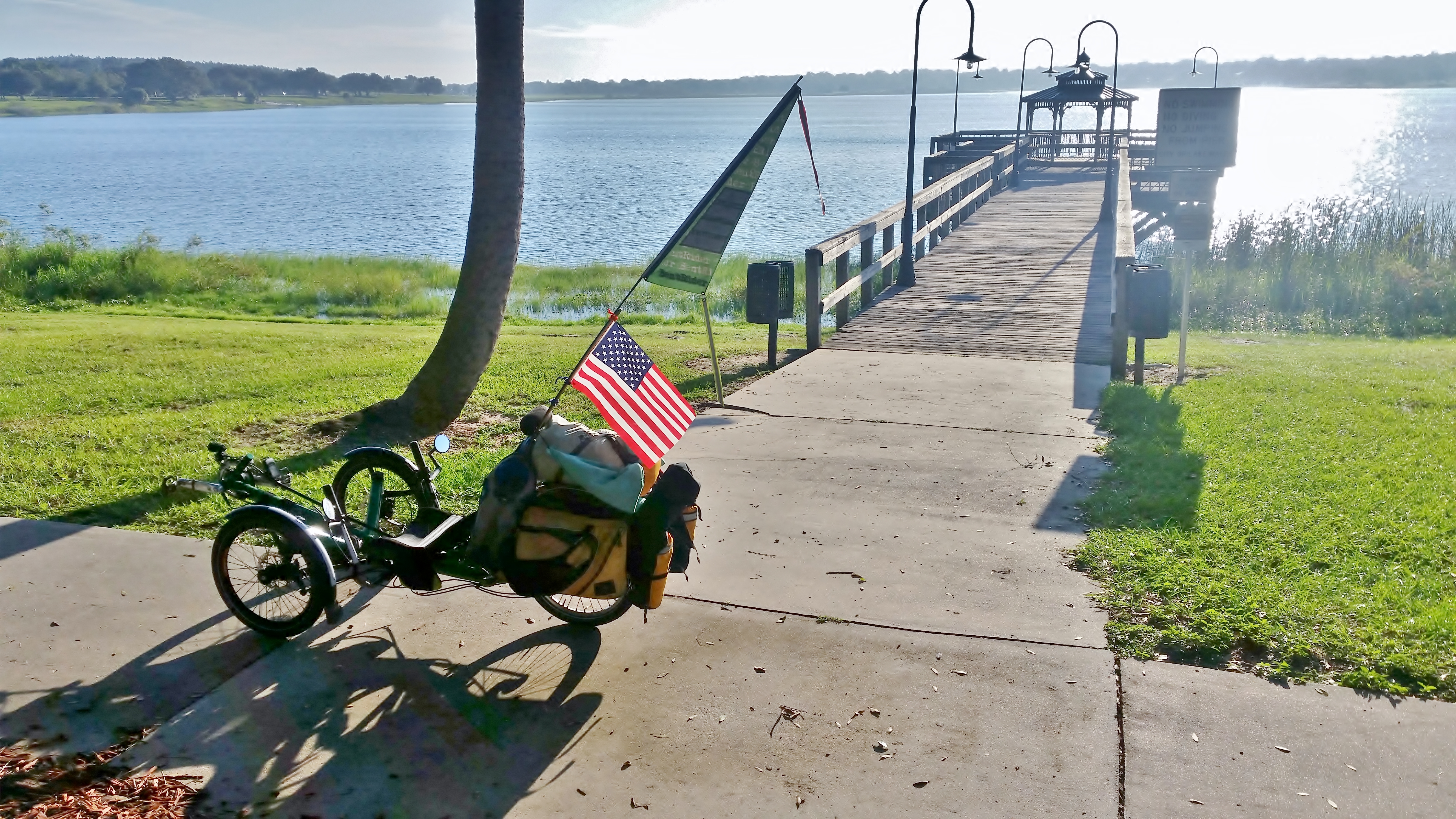
The ride out of the campground is very nice. Very small streets through sleepy residential neighborhoods. I ride past a couple of small lakes and into the down town part of Lake Wales. I take a short detour to take a look at the lake itself, and to ride part of the 2.5 mile bike path running around the lake. For some reason I see signs talking about the lake as ‘Lake Wailes’, even though the town itself is Lake Wales.

Boc Tower & Gardens
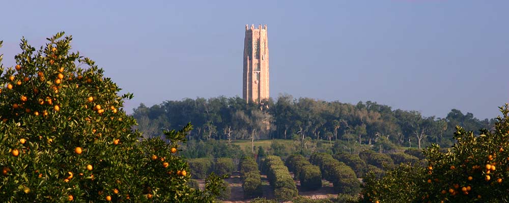
Boc Tower is a National Historic Landmark, contemplative garden, and bird sanctuary located north of Lake Wales, right on the route I ride out-of-town. It consists of a 250-acre garden, the 205-foot (62 m) tall Singing Tower with its carillon bells, and a visitor center. The gardens were built in the 1920’s by Edward W. Bok, editor of the popular women’s magazine Ladies Home Journal and his wife. The gardens were designed by famous landscape architect Frederick Law Olmstead, Jr.
I arrived to early in the morning and the place was not yet open, so I couldn’t really check it out for myself, but it looks like it would be really nice inside.

Spook Hill
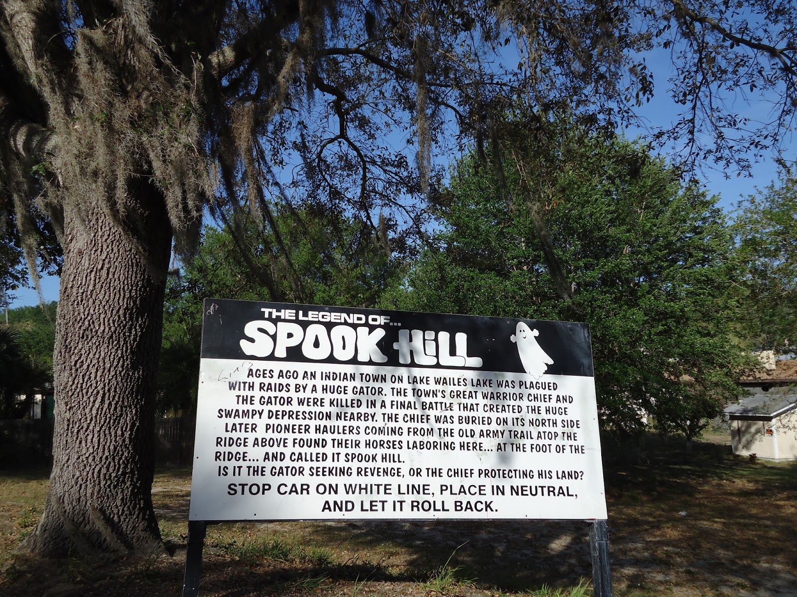
Just a little ways past the entrance to Boc Tower I rode past the Spook Hill Elementary School. Just down the road is the famous Spook Hill. Spook Hill has gained worldwide notoriety as one of the most confounding, potentially haunted, locations in existence. Visitors come to Lake Wales from around the world to park their cars at the bottom of Spook Hill and experience the mysterious force that seems to defy gravity and push the car up to the top of the hill. It’s all an optical illusion, but seems to draw a regular crowd. I rode by early in the morning, and there were already a small line of cars waiting to give it a try.
Haines City
I continue to ride north. The route remains pleasant. There are a few small lakes in the area, and a few larger ones. The road remains quiet – it mostly runs past upscale vacation homes built on the lake shores. I ride past Lake Pierce and Lake Marion and ultimately approach Haines City. I don’t see much of the city – my route keeps me slightly top the east of the main down town area. I could stop here to eat, but I decide to keep on riding instead.
Haines City has seen a lot of growth in recent years, primarily because of its easy access to Orlando and the Walt Disney Word Resorts. As I ride into and north of the city I notice a definite change in the traffic. Its starting to pick up a bit.
Davenport
The next city up is Davenport. The road between Haines City and Devenport is Power Line Road. This is the first stretch of really bad road I have met so far. The road itself is typical of the roads I have ridden – narrow, one lane each direction, no shoulder. But on Power Line Road, most of the traffic is power company service trucks. They all seem to be in a hurry, and I am constantly worried that they might not see me despite being right in the middle of the lane. Fortunately the sight lines are good, and for the most part the trucks can get around me with no problems, but a few times I bail on to the grass along the side of the road just to be sure.

When I finally reach Davenport, I’m ready for a break, I ride around town and find a small cafe to have lunch. I’m pretty rattled. As I write this now I can’t remember much about where or what I ate, I just recall thinking that I wanted to get away from the trucks and off the trike for a while. I sit in the cool, air-conditioned cafe and try to decide what to do next.
My original plan for today had me riding another 40 miles or so into the town of Winter Garden. I don’t want to do that now. Checking my maps and my phone I decide that I can stay in a campground about 8-9 miles away in the town of Loughman. That sounds good to me! With a new plan and a full belly, I head back out.
Mouse Mountain
North of Davenport, traffic remains heavy. I follow the Lee Jackson Highway north of 8 miles into the town of Loughman. Now I have some small problems – I don’t have the route to the campground programmed into the Garmin, so I need to follow the directions I got when I called the campground. I also have almost no food with me, so I’ll need to stop to get something to have for dinner.
The name of the place I am going is Mouse Mountain – another RV Campground/Resort. It is only 6 miles from Disney word. They claim to have a view of the Disney Resort from the campground. I looked for it while I was there, but didn’t see it. Perhaps I just didn’t recognize it.
Anyway – I fumble along following directions as best I can and avoiding constant car and truck traffic at the same time . When I think I am getting close, I stop at a Publix Supermarket to get some food. I get a giant Publix Roast Beef Sandwich along with some fruit and some junk food and go to the checkout.
While paying for my food I ask the cashier if she knows where Mouse Mountain is. She looks a little freaked out. But I explain my situation to her and then she tells me that yes, she knows where it is, because she lives there! It’s very close – only about a mile away. She has lived there – in a double wide RV for several years – really likes it.
OK! I’m off again and in no time find myself setting up camp at the Mouse Mountain RV Resort. Another nice grassy campsite. I get set up, take a shower, use the pool and generally relax for a while. There is a 7-11 just across the street, where I get a cold beer and bring it back to camp with me.
Need A New Plan
Well, I am now 30 miles behind what I planned for today. I could try to make it up tomorrow, but I don’t think I’m up for a 90+ mile day. I’m gonna need to replan the rest of the ride. Also, the traffic is really bugging me – if the traffic stays this bad I’m not sure I’ll bother with finishing at all. Some of the ride has been pretty nice – but the bad parts are really bad. I sit in my campsite, eat dinner and study maps. Looks like I can get to Mt. Dora tomorrow. There are lots of hotels and B&B’s there, and I think a night in a nice comfy bed sounds pretty appealing. With that much of a plan in mind, I head for bed….


