Today was a day just begging for a bike ride. I woke early to find temperatures in the middle 50’s, with forecast highs in the middle 70’s. The sun is shining, the humidity is low, and a gentle breeze is blowing. Wow! That’s the coolest, nicest weather I can remember since moving to Florida last spring. Time to ride!
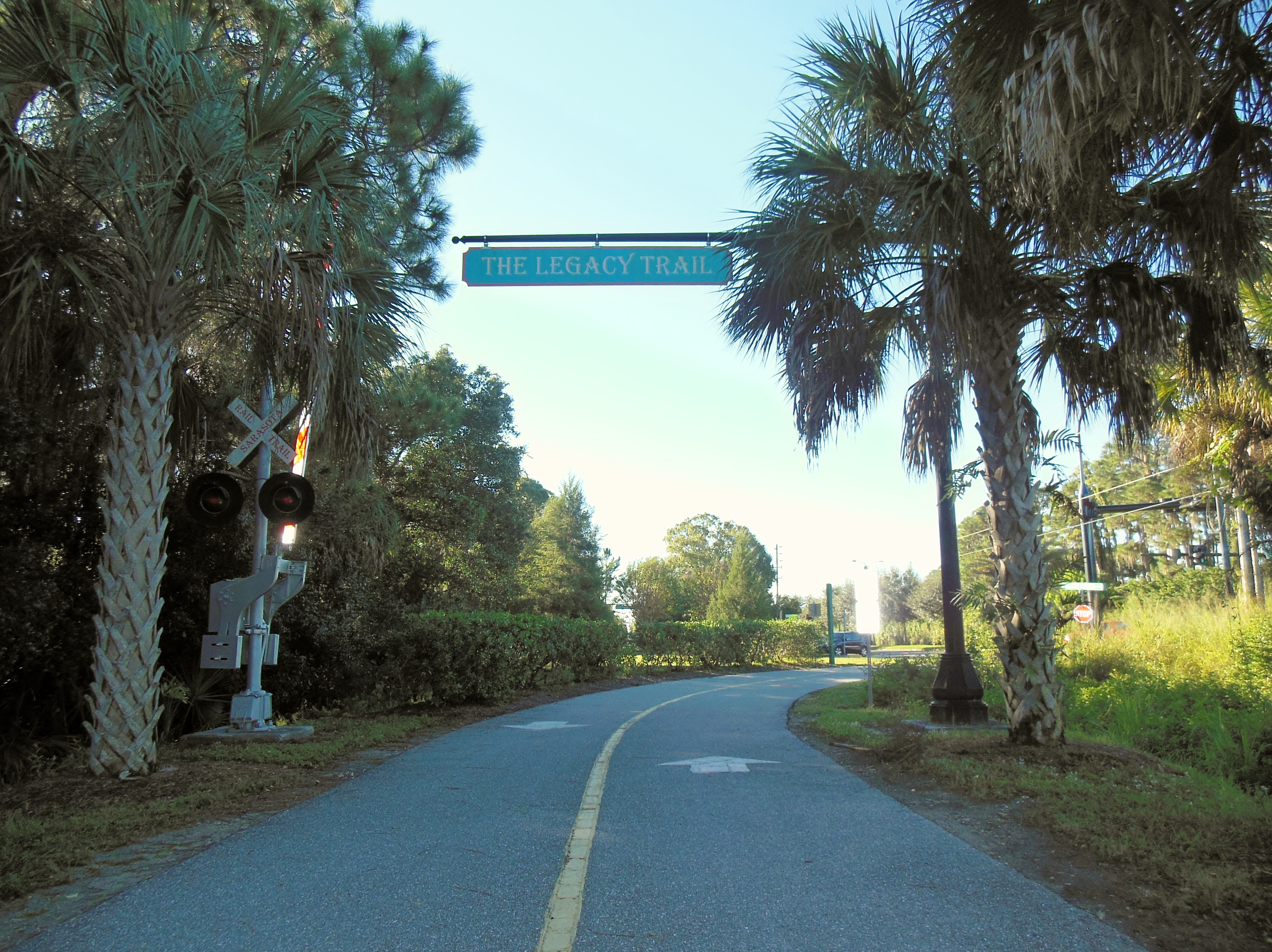
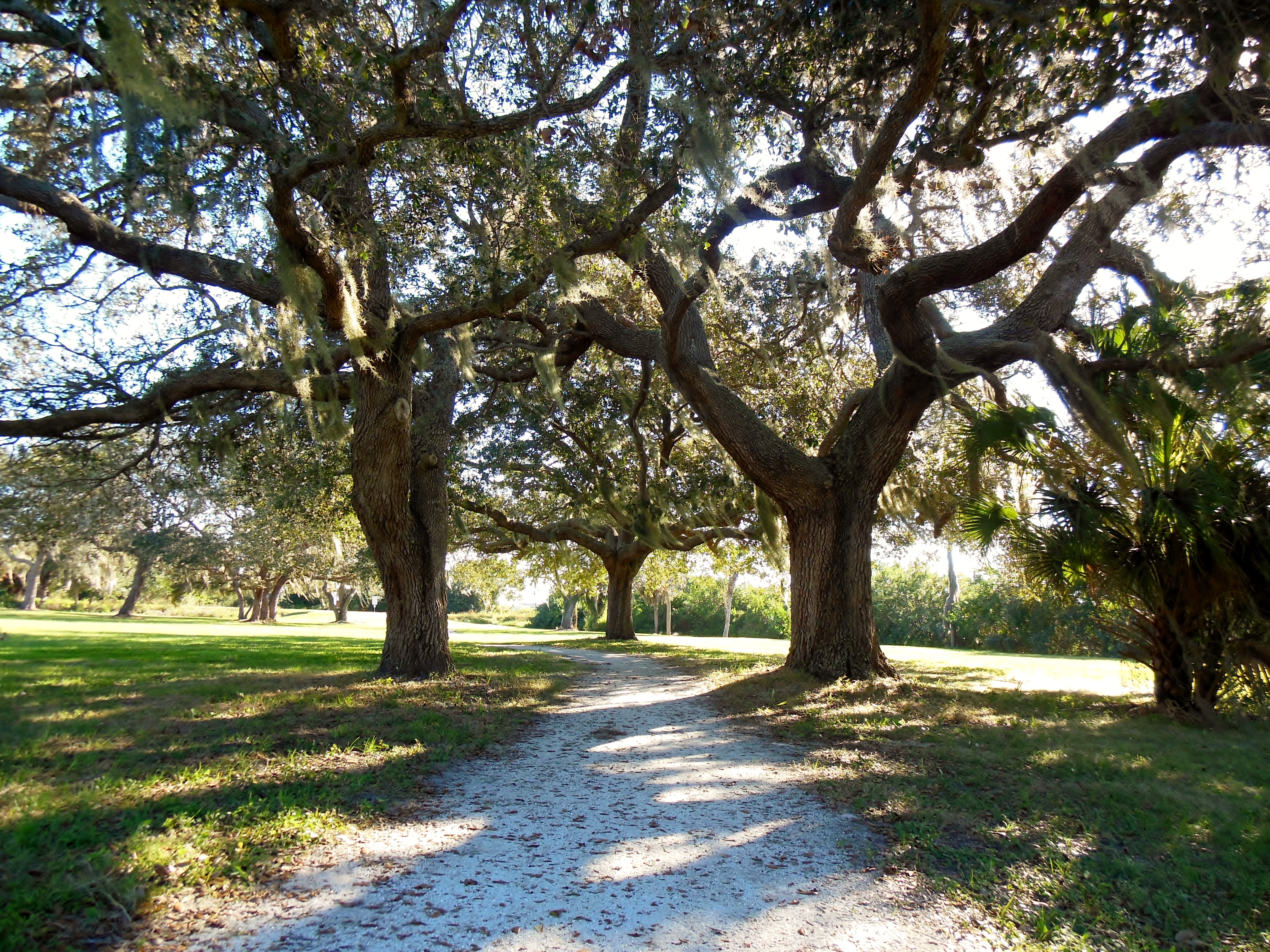
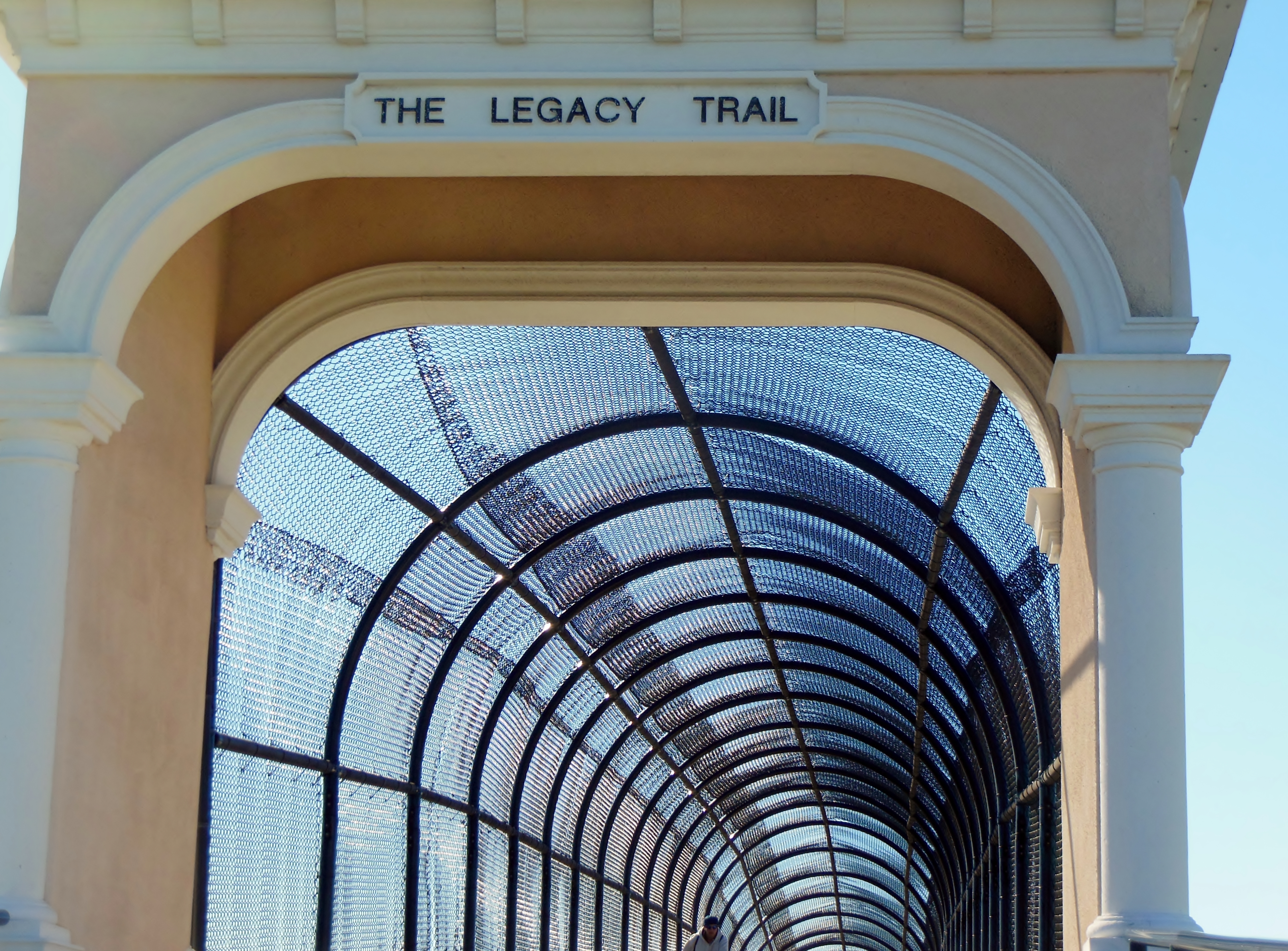
It’s been a while since I visited the Legacy Trail, so I load up the trike and head south to check it out on this glorious Fall day. The Legacy Trail is Sarasota’s own rail-trail. It’s a classic Florida ride – flat and straight through heavy foliage. Throw in a few pretty water views – and it makes for a great ride.
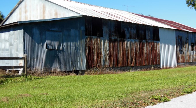
It’s a relatively new trail – the official opening was in 2011. The trail runs on top of the railroad tracks that were originally laid in 1911 to service the Ringling Bros. and Barnum & Bailey Circus’s winter quarters. The railroad was expanded, bought, and sold a bunch of times over the years. The last trail rolled through in 1971.
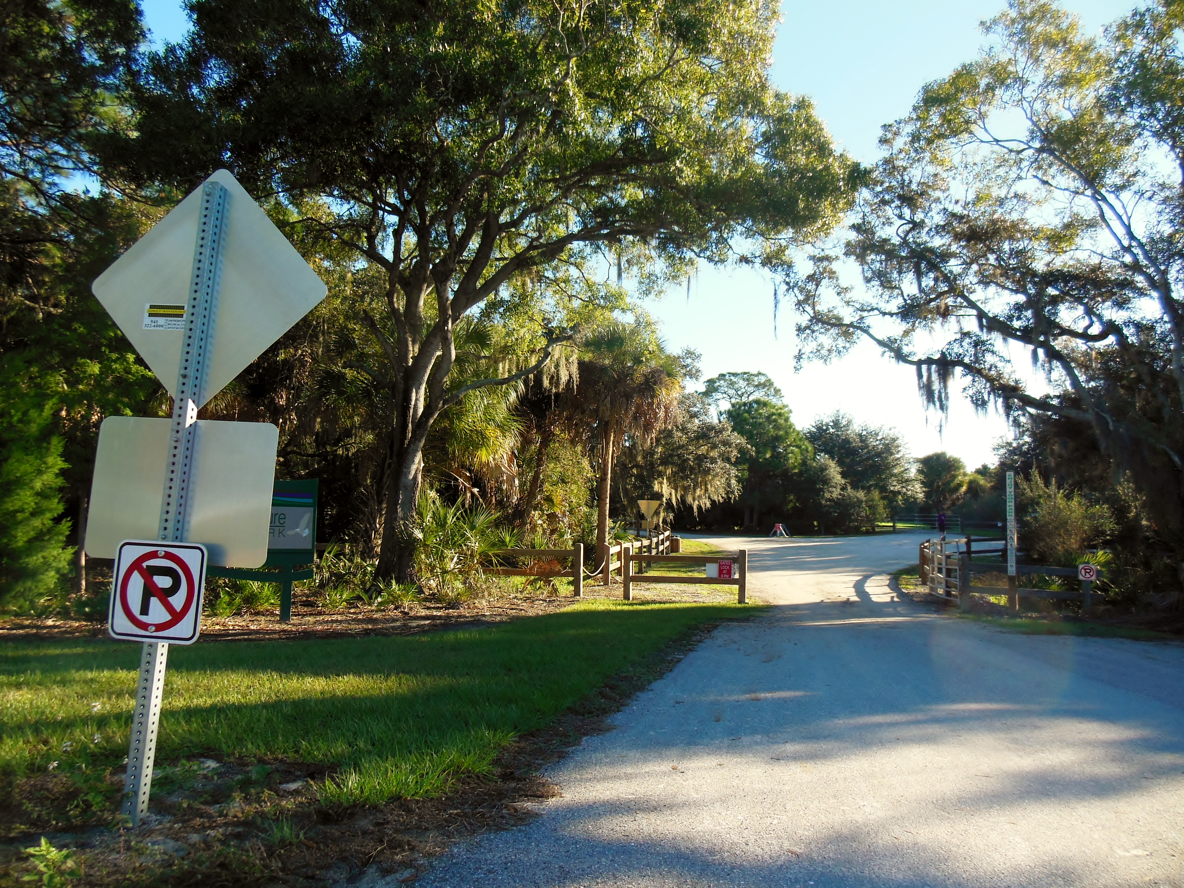
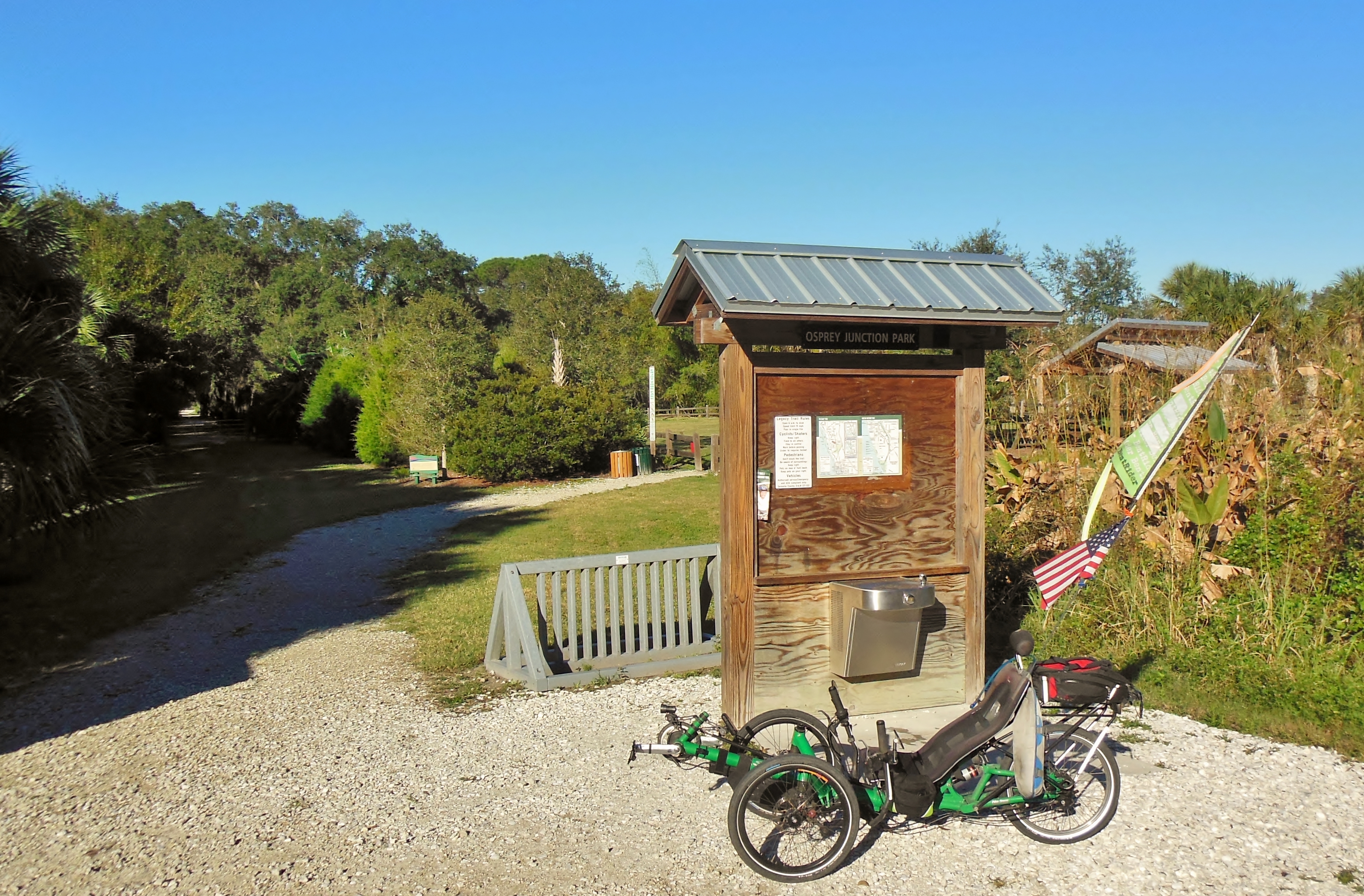
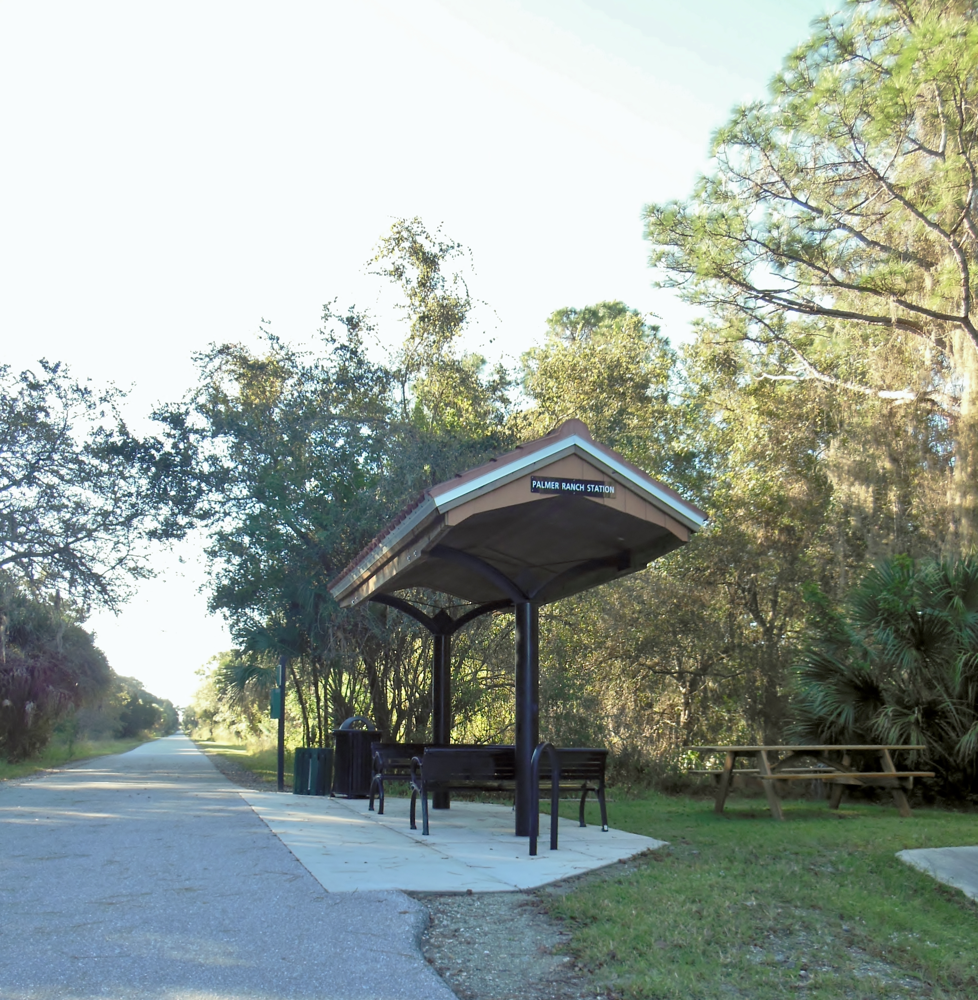
I park at the northern-most trail-head – at Culverhouse Park just south of Clark Road in Sarasota. The trail has 8 trail-heads, spaced fairly regularly along it’s 10 mile length. Each trail-head offers plenty of free parking (except for the state park – you gotta pay a fee there), and most offer restrooms (porta-potties), picnic tables and shade. Several have water available.
The county published an excellent trail map of the Legacy Trail that you can download to get more info about the locations of the trail heads. (Legacy Trail County Map).
 I’m actually a little chilly as I pedal out of the parking lot and head south on the trail. I cannot remember the last time I felt cold – what an odd feeling! After a few miles on the sunny trail my muscles begin to warm and the chill goes away. I have the breeze on my back this morning, so I make pretty quick work of the miles.
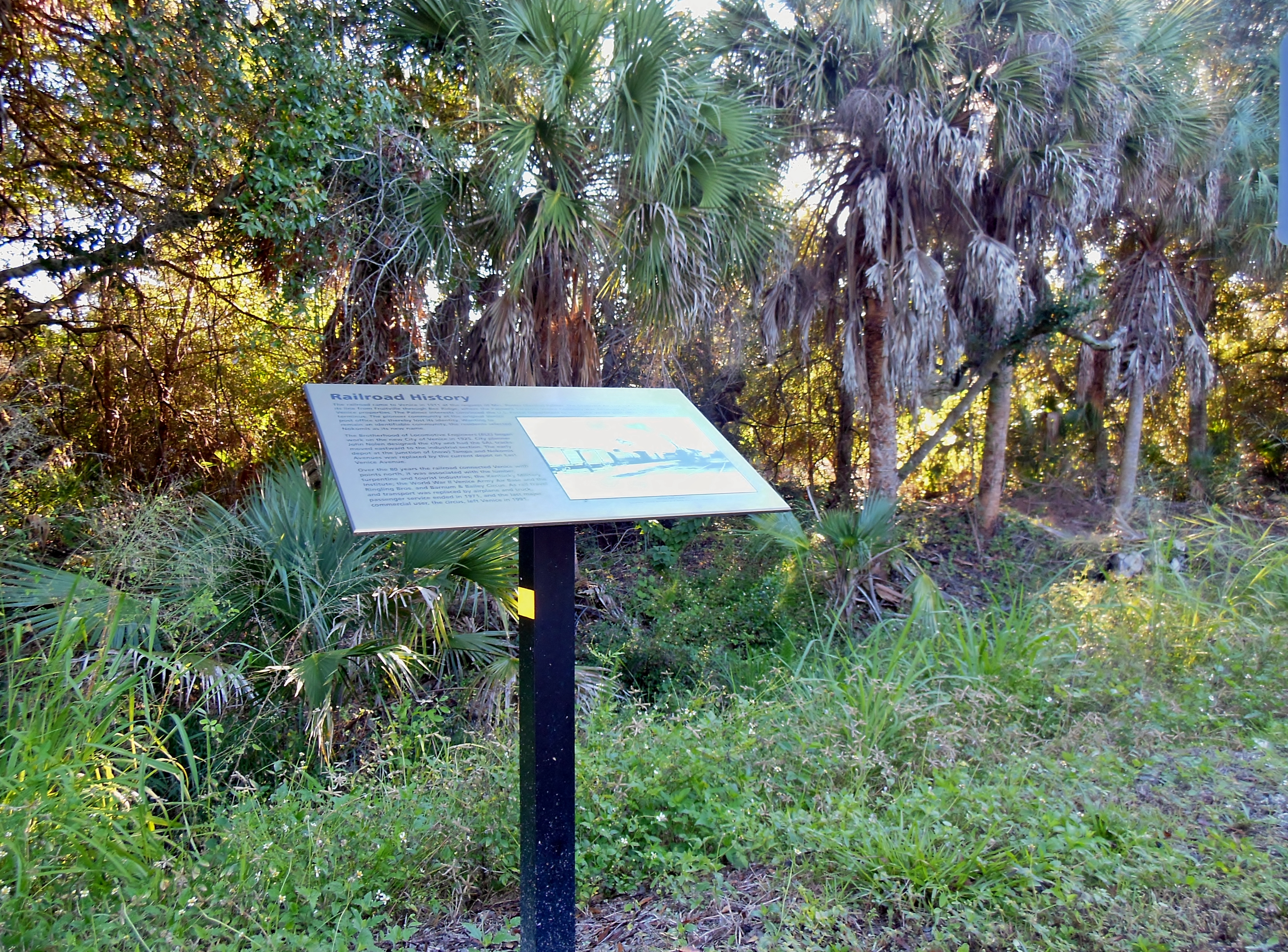
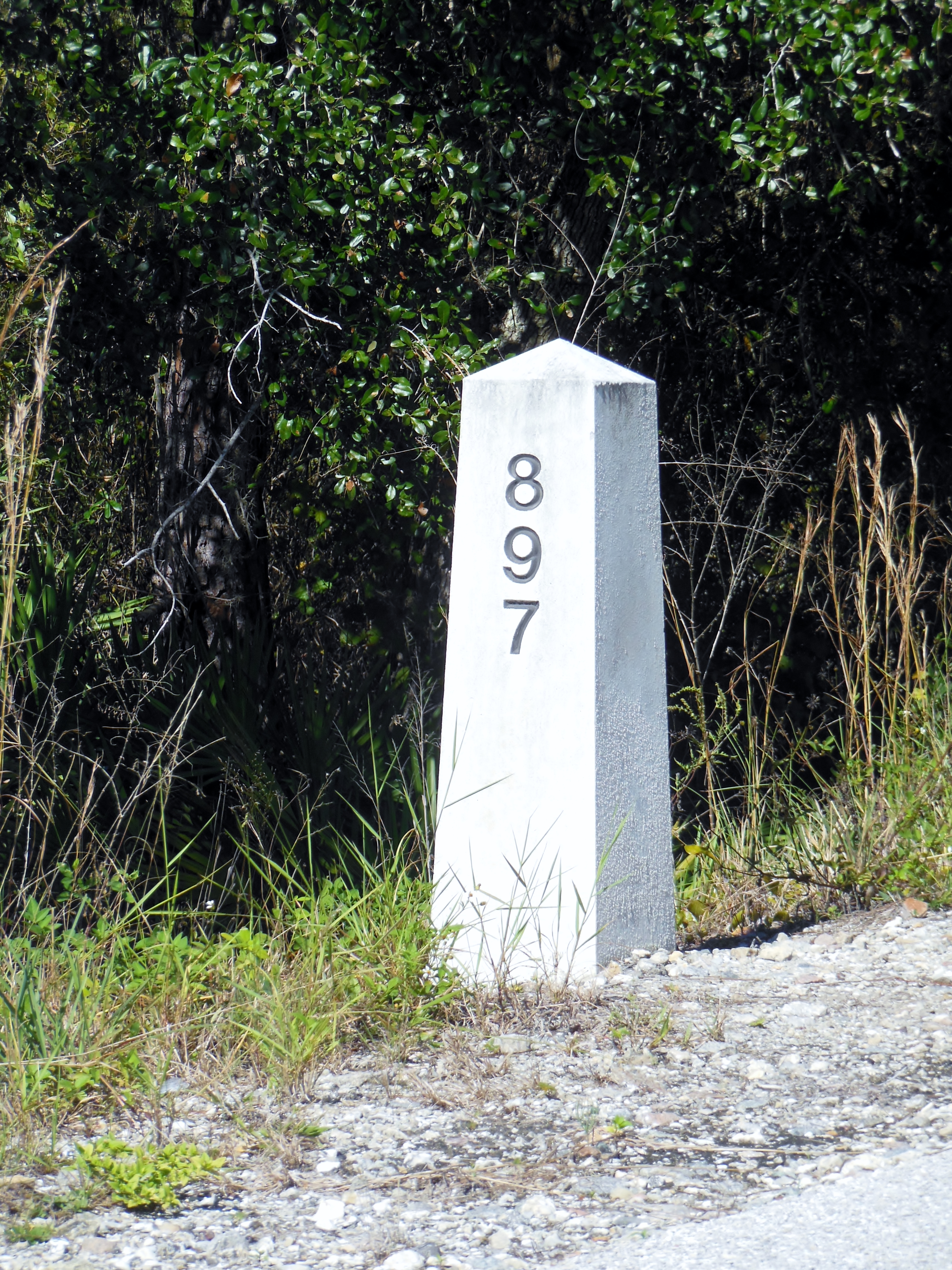
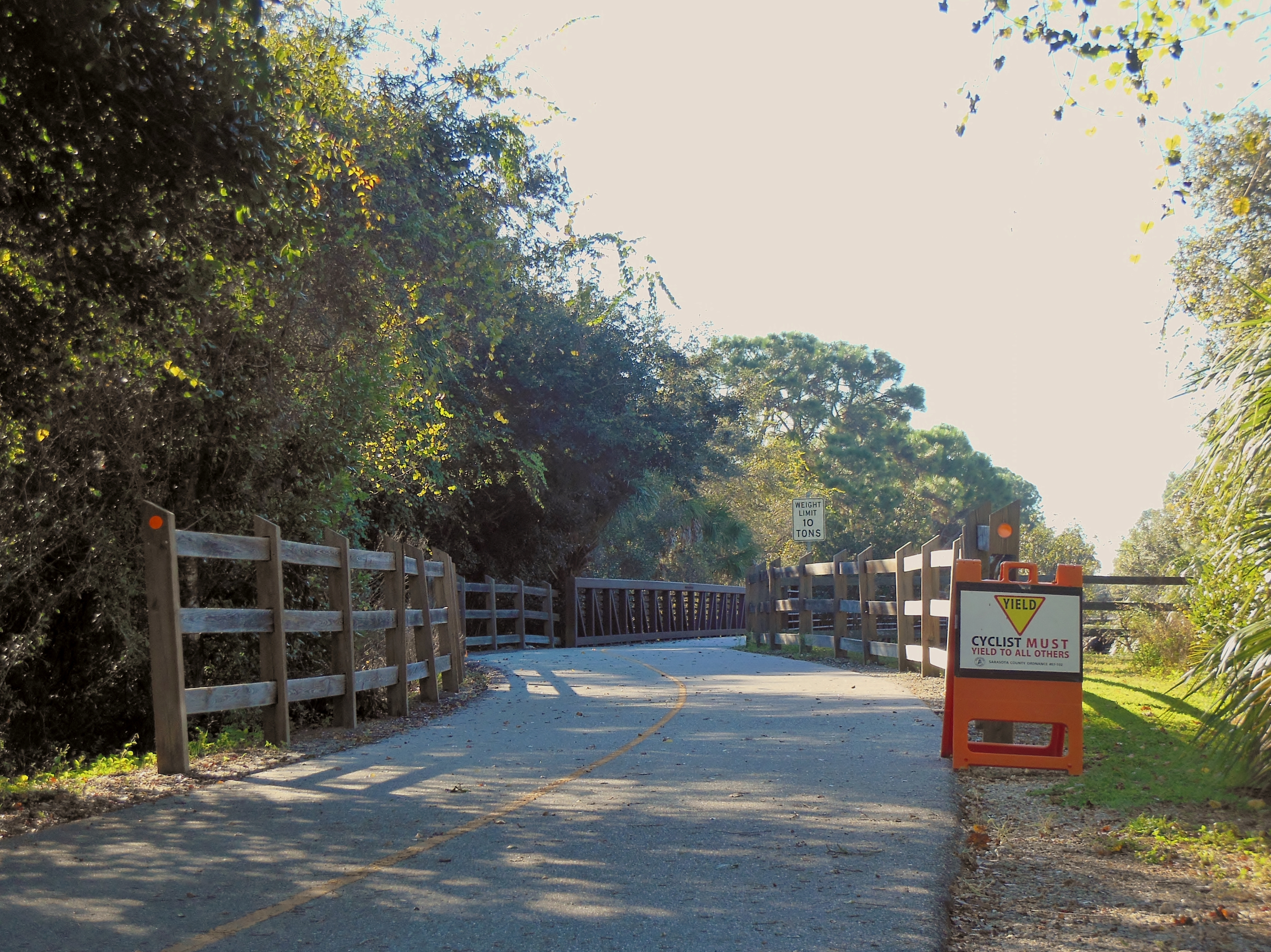
The trail is completely paved and has informative signs every half mile or so that describe the history of the railroad, the local area, and the flora and fauna to be found along the trail. Small granite mileage markers are visible each mile along the trail. The numbers represent the mileage from the railroad’s northern terminus, which was originally in Richmond, Virgina.
The trail runs south out of Palmer Ranch, through Osprey, and into the 1300+ acre Oscar Scherer State Park. The park offers a lot of great outdoor activities – hiking, canoeing, swimming, bird-watching, etc. It’s a pretty park, and well worth a visit. But be warned – it’s necessary to pay the State Park Entry Fee even if you ride into the park from the trail.
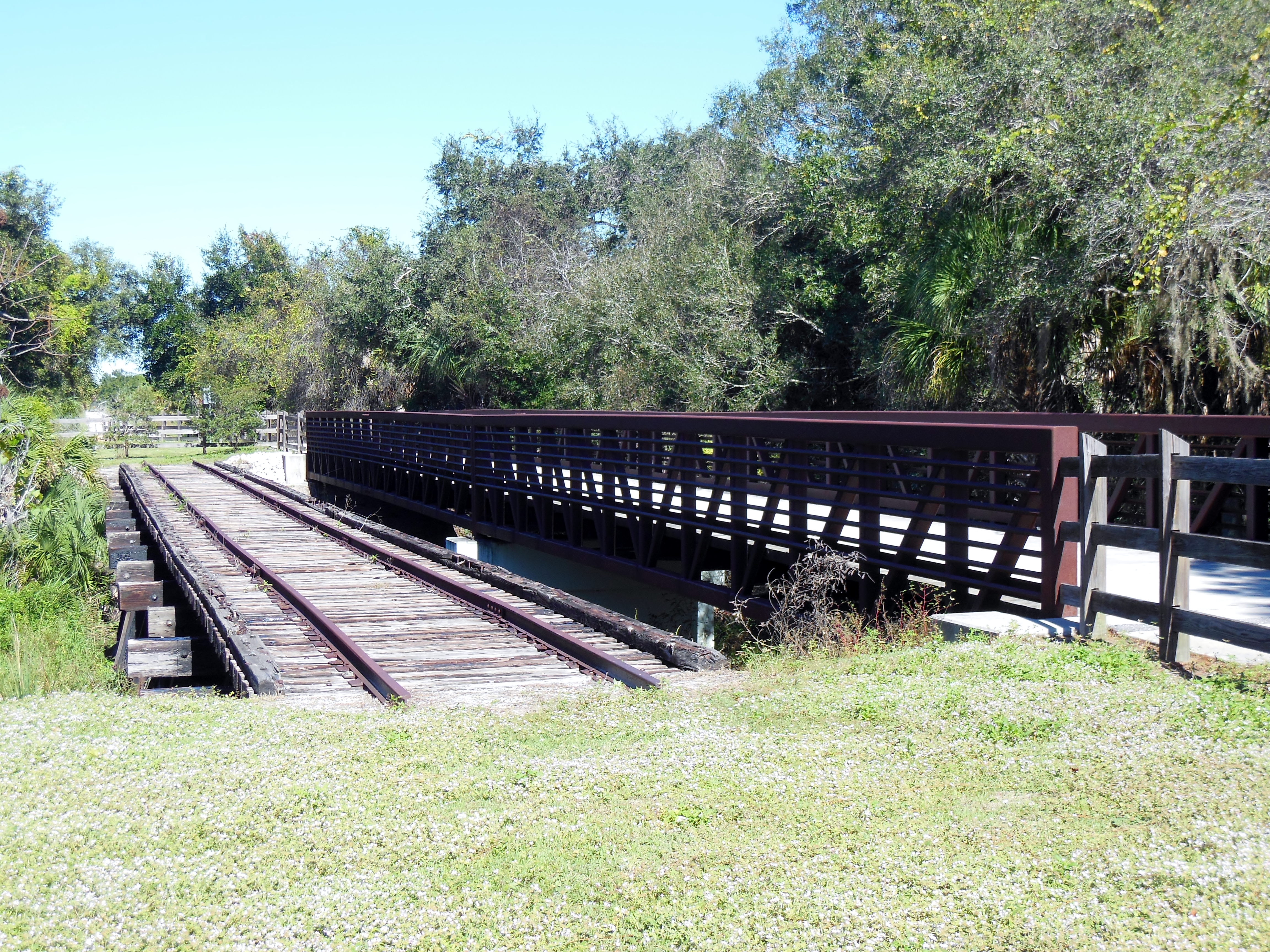
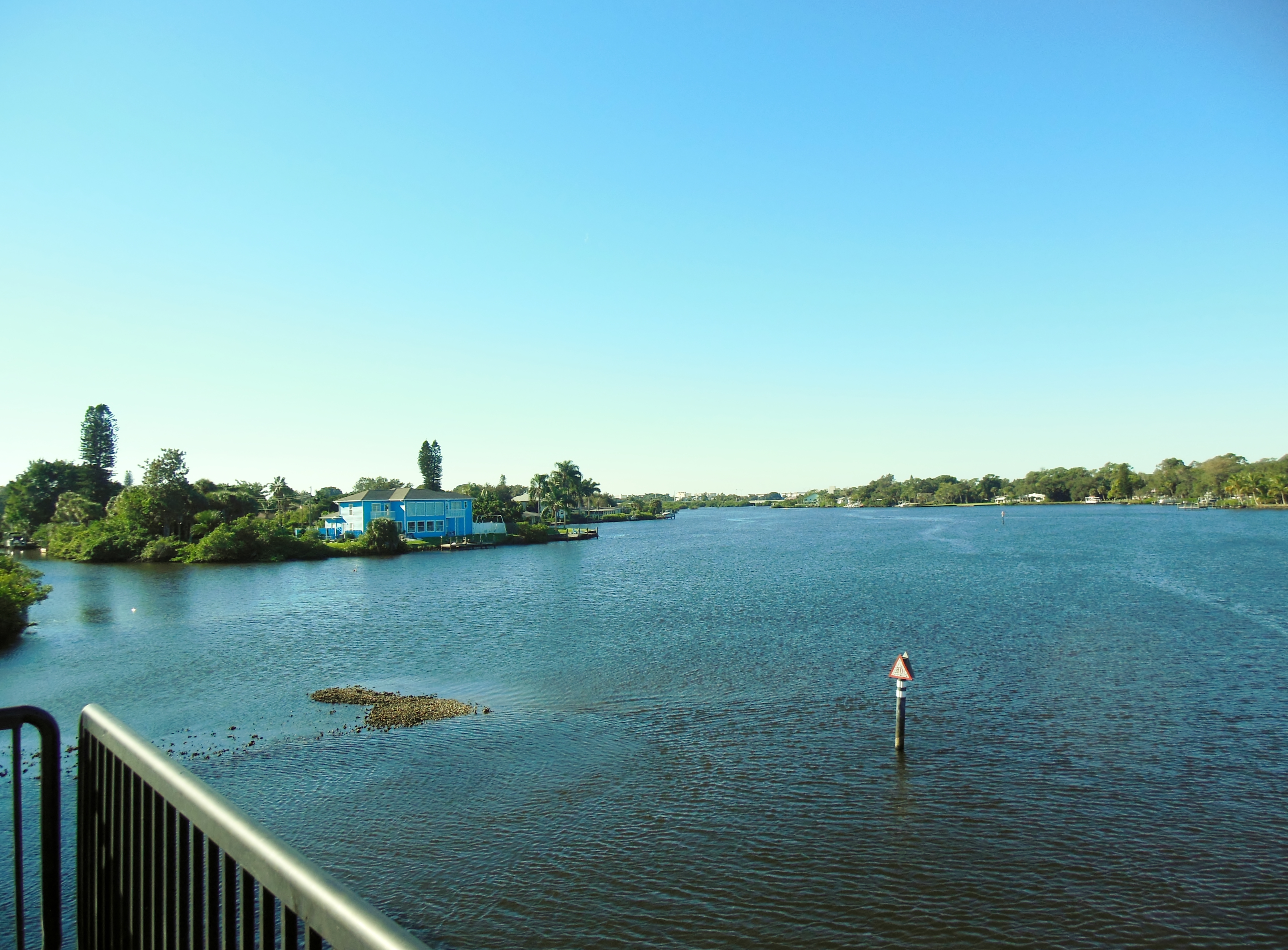
After leaving the State Park, the trail passes under the FL681 Highway Bi-pass and then leads through the neighborhoods of Laurel and Nokomis. These areas are close to the water and have lots of streams and inlets. The trail has some interesting bridges and very pretty water views as it crosses scenic bays.
Before leaving Nokomis, if you feel a break is in order, then the Nokomis Community Park is a good choice. With easy access right off the trail, the park offers shade, water, restrooms and a short, unpaved trail which is a pretty interesting ride all on its’ own.
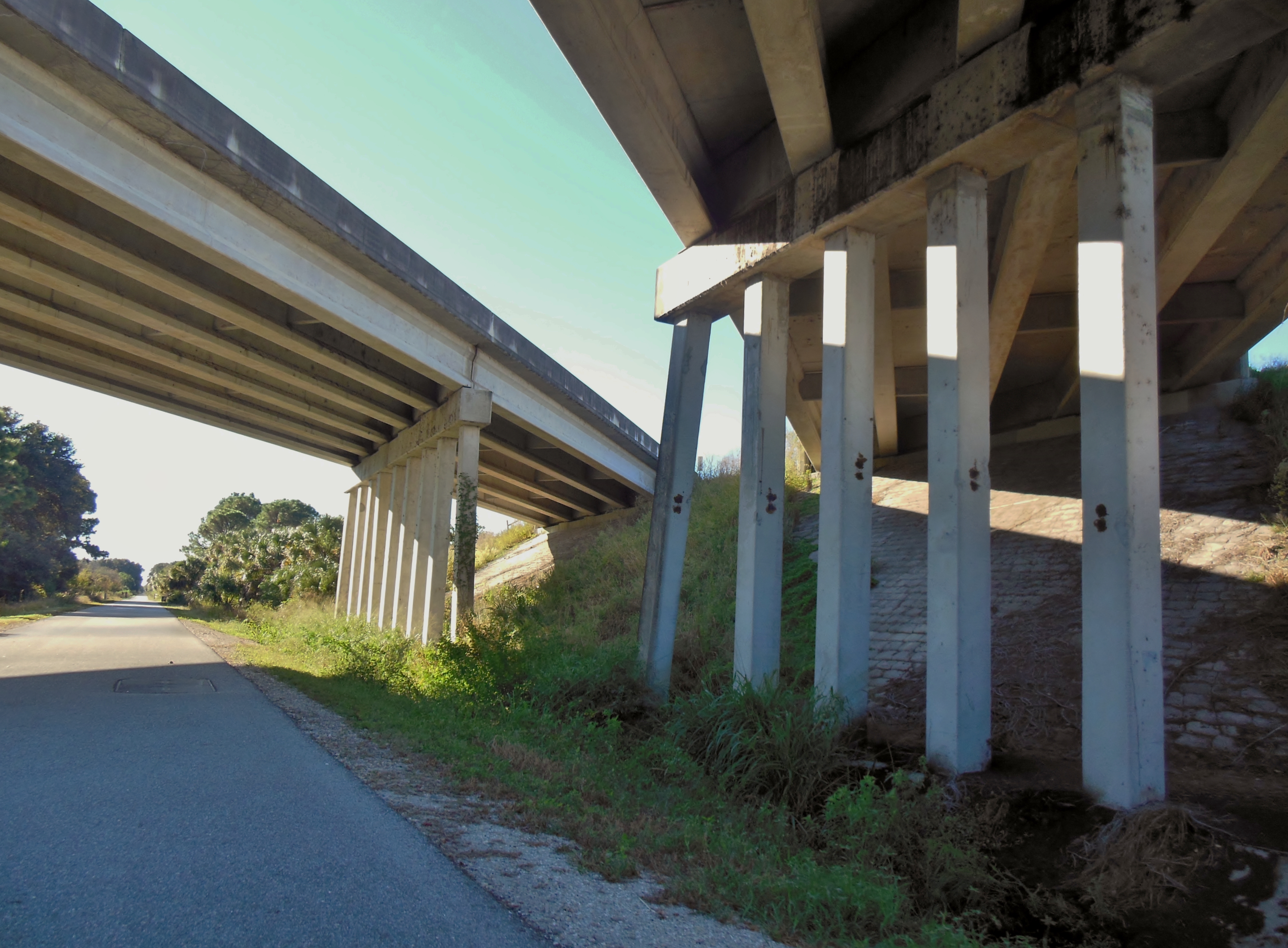
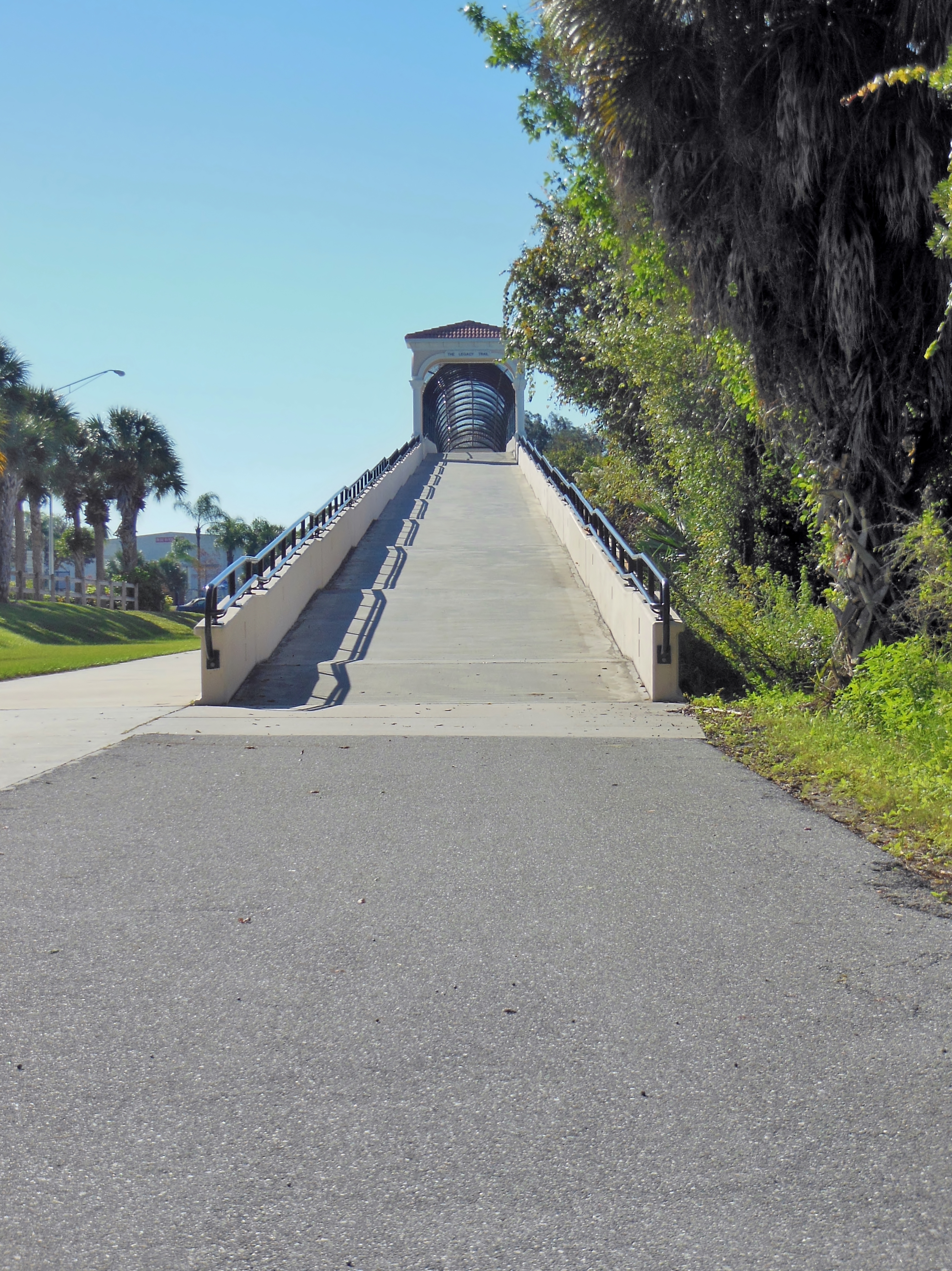
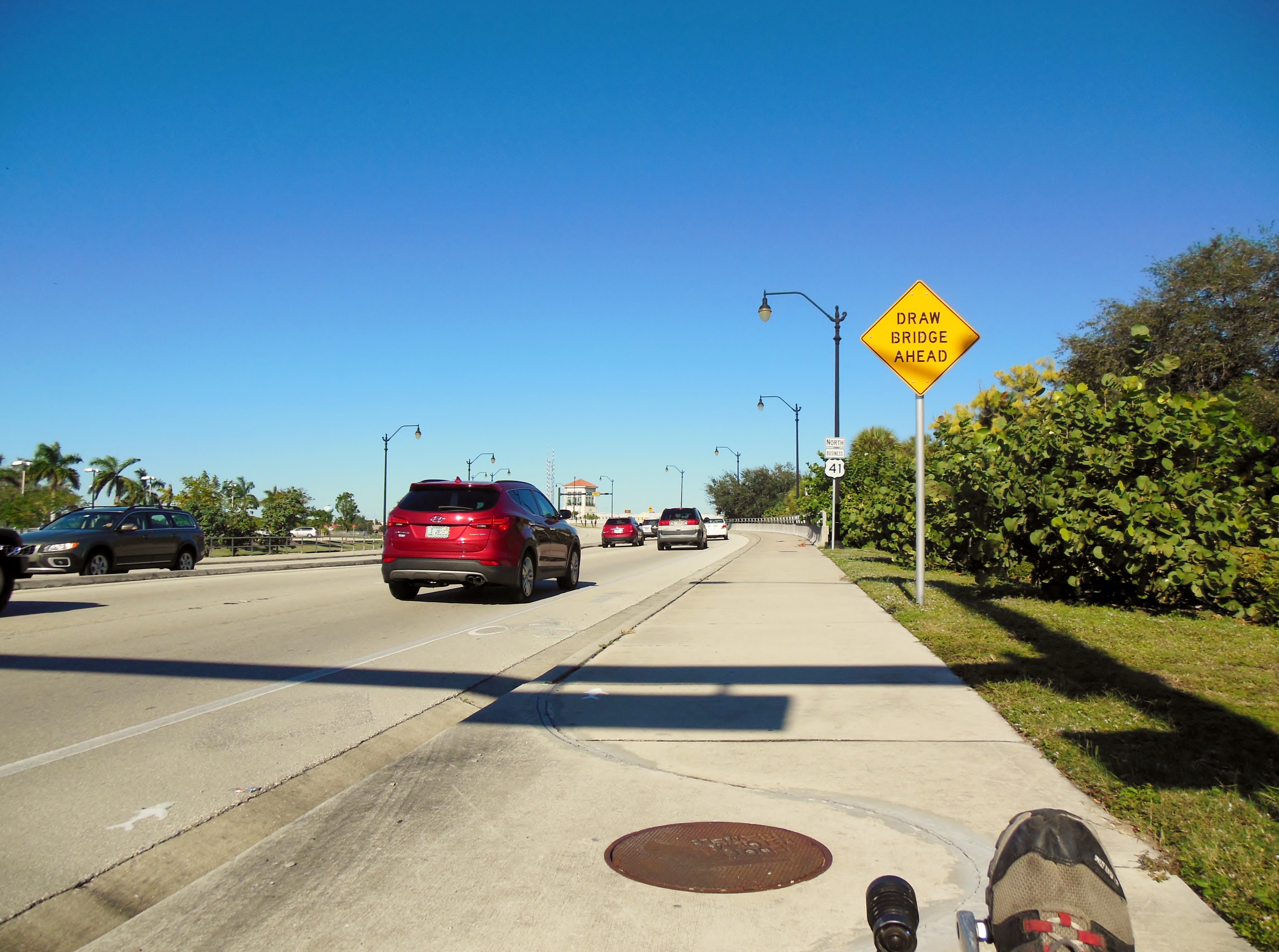
The trail leaves Nokomis and heads toward Venice. This is a critical juncture on this trail, because now riders must prepare to climb the biggest hill in Sarasota County. That’s right, it’s the Highway 41 pedestrian overpass! Shift into your low gears and pull your way to the top of this enormous incline. Then sit back, relax, and enjoy your well-earned rush back down the far side
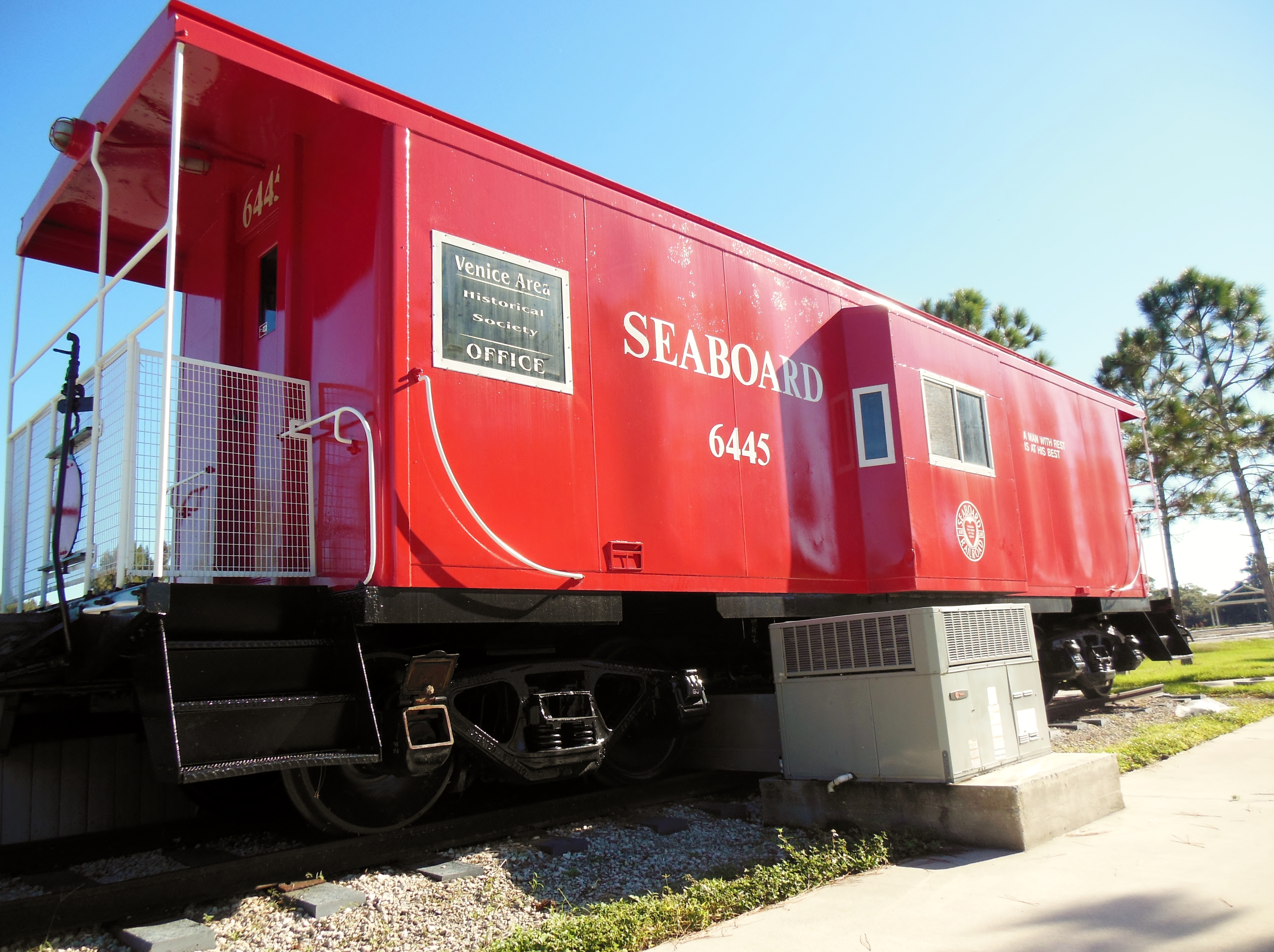
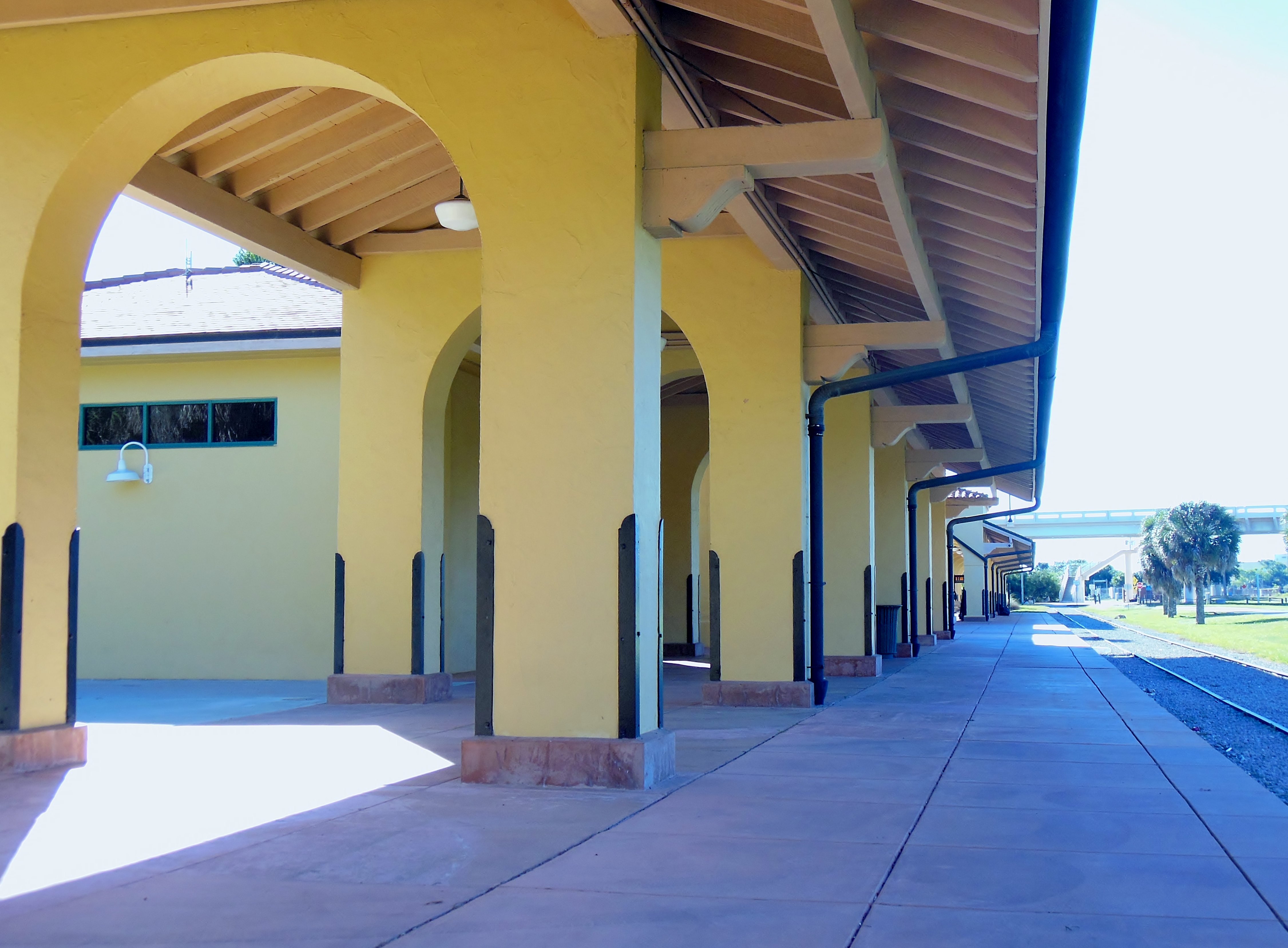
Descending from the dizzying heights of the overpass, make a quick left into the Venice Train Station. The station now houses the Venice Area Historical Society Museum, along with event space that is privately rented. Bus services to the local area runs from the waiting area at the south end of the station. A former red Seaboard Air Line freight car, now restored and used as offices for the Historical Society, stands beyond the station’s north end next to a large freestanding wooden deck.
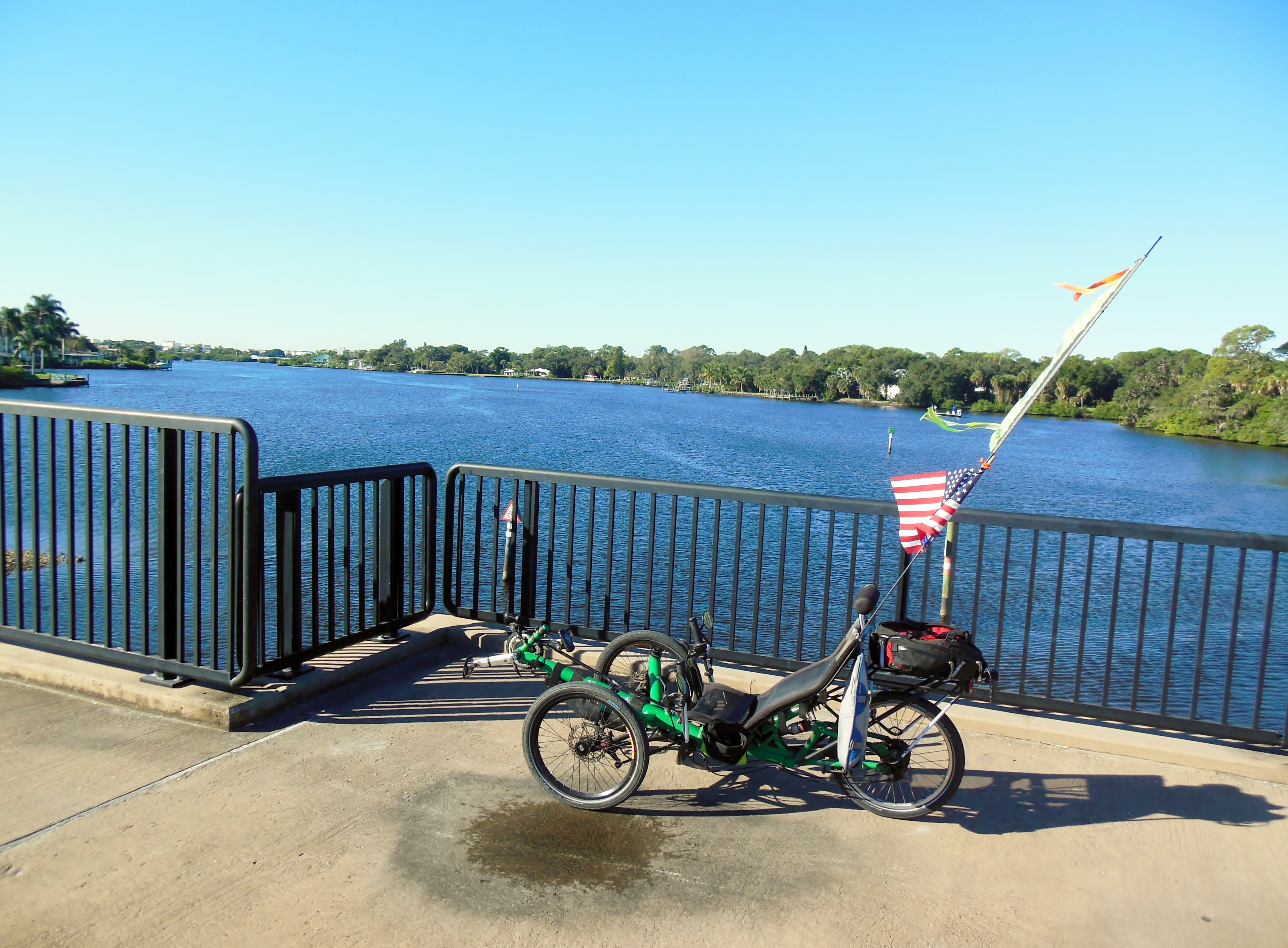
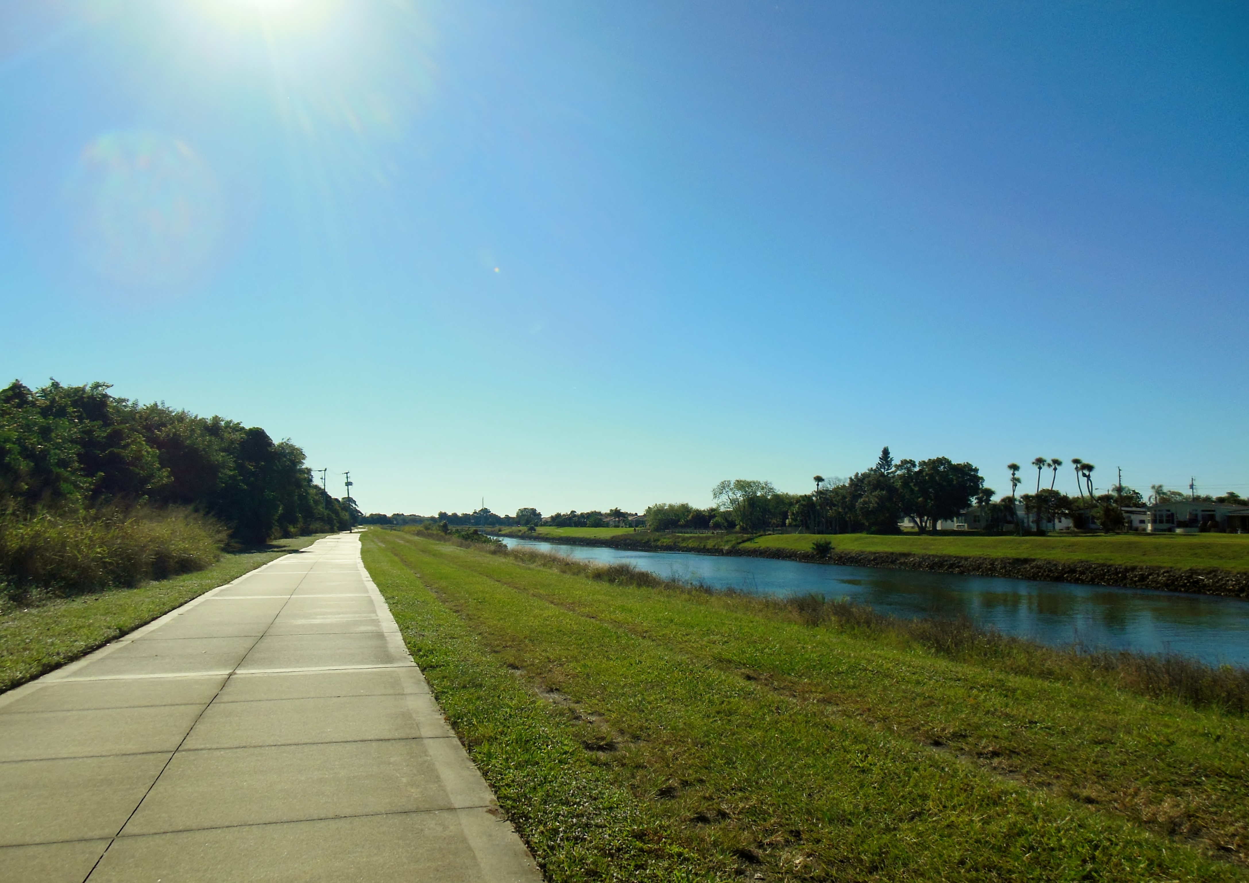
The south end of the Legacy Trail connects to the short Venice Waterway Trail here at the station. This trail follows along both sides of the Inter-coastal Waterway, from near Downtown Venice out to the Gulf of Mexico. It’s possible to ride the trail on either side of the waterway – but today I choose to ride the north side – because it offers easy access to the beach.
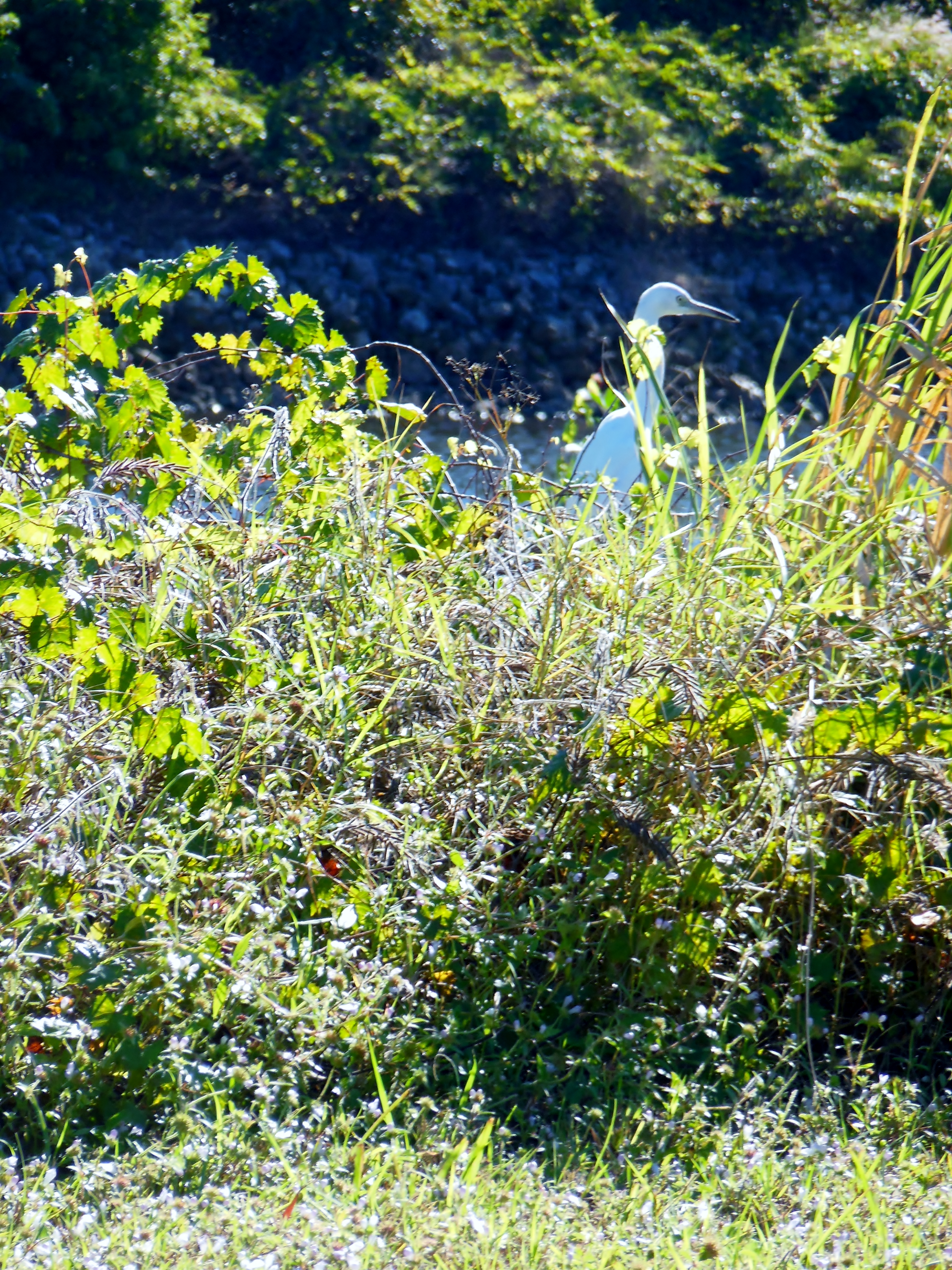
Keep a sharp eye out as you ride along the waterway – you will see plenty of water birds, maybe some eagles and possibly manatees in the water.
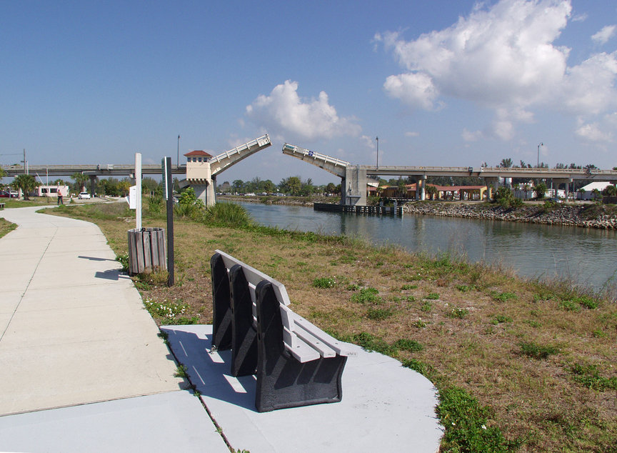
Not far from the Venice Train Station is the Circus Bridge. This bridge crosses the Inter-coastal Waterway and connects the mainland town of Venice with the island portions. The bridge is a working drawbridge. It opens regularly to allow boat traffic to travel up and down the waterway. If you’re lucky, you will catch it being opened.
Cross the bridge on the sidewalk -there is a nice wide sidewalk on both sides with plenty of room to accommodate both bikes and pedestrians. There is also an acceptable bike lane across the bridge – but I’ve always found the sidewalk more convenient.
There are some decisions to make at this point. If you are hungry, then continue across the bridge and ride a mile or two into the town of Venice. There you can find a variety of restaurants and shops for almost any appetite. This is actually one of Nancy’s favorite outings – we have ridden into Venice for breakfast or lunch on several occasions. Stay tuned, as there will certainly be some restaurant reviews from these places before the winter is over.
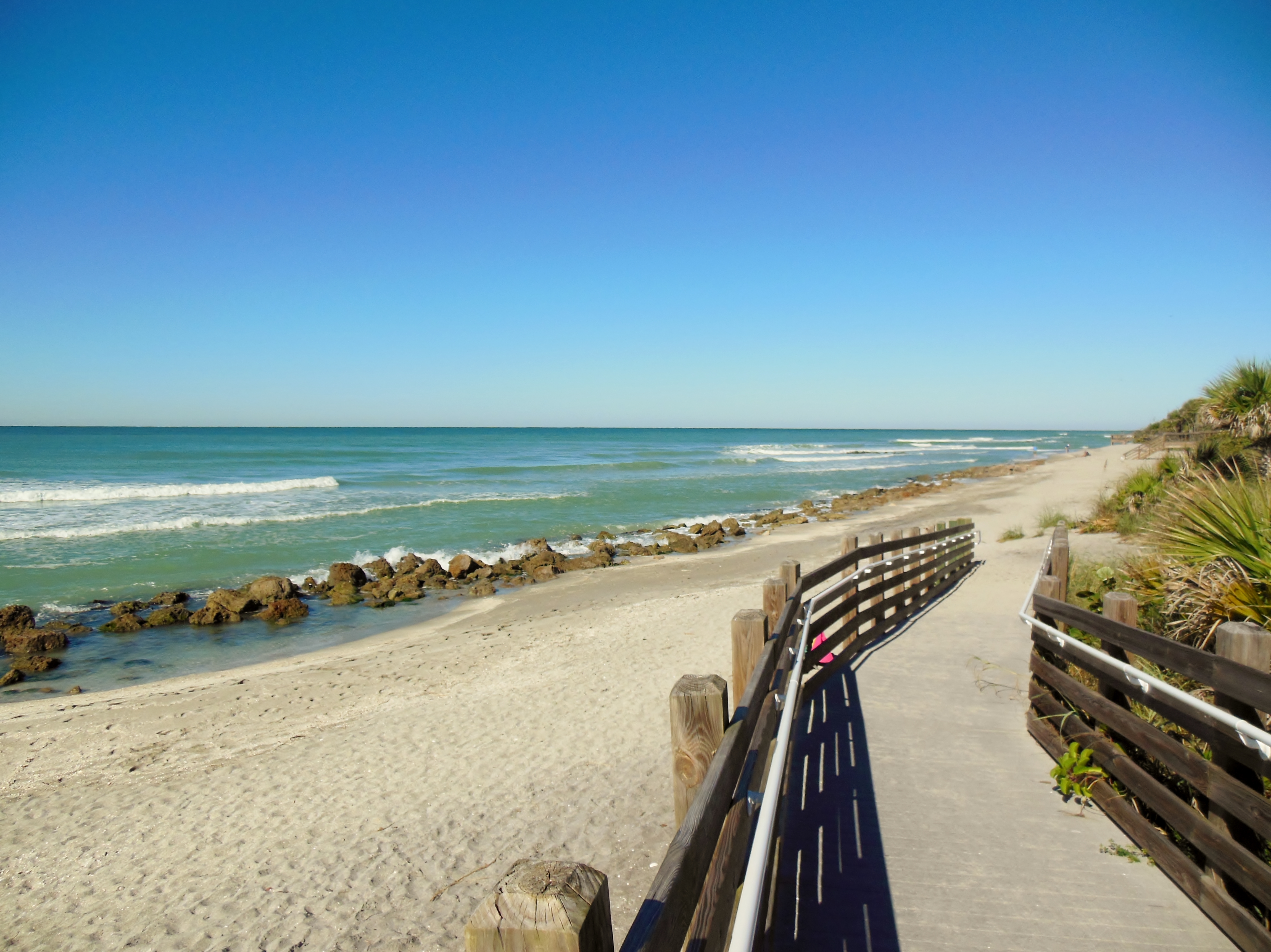
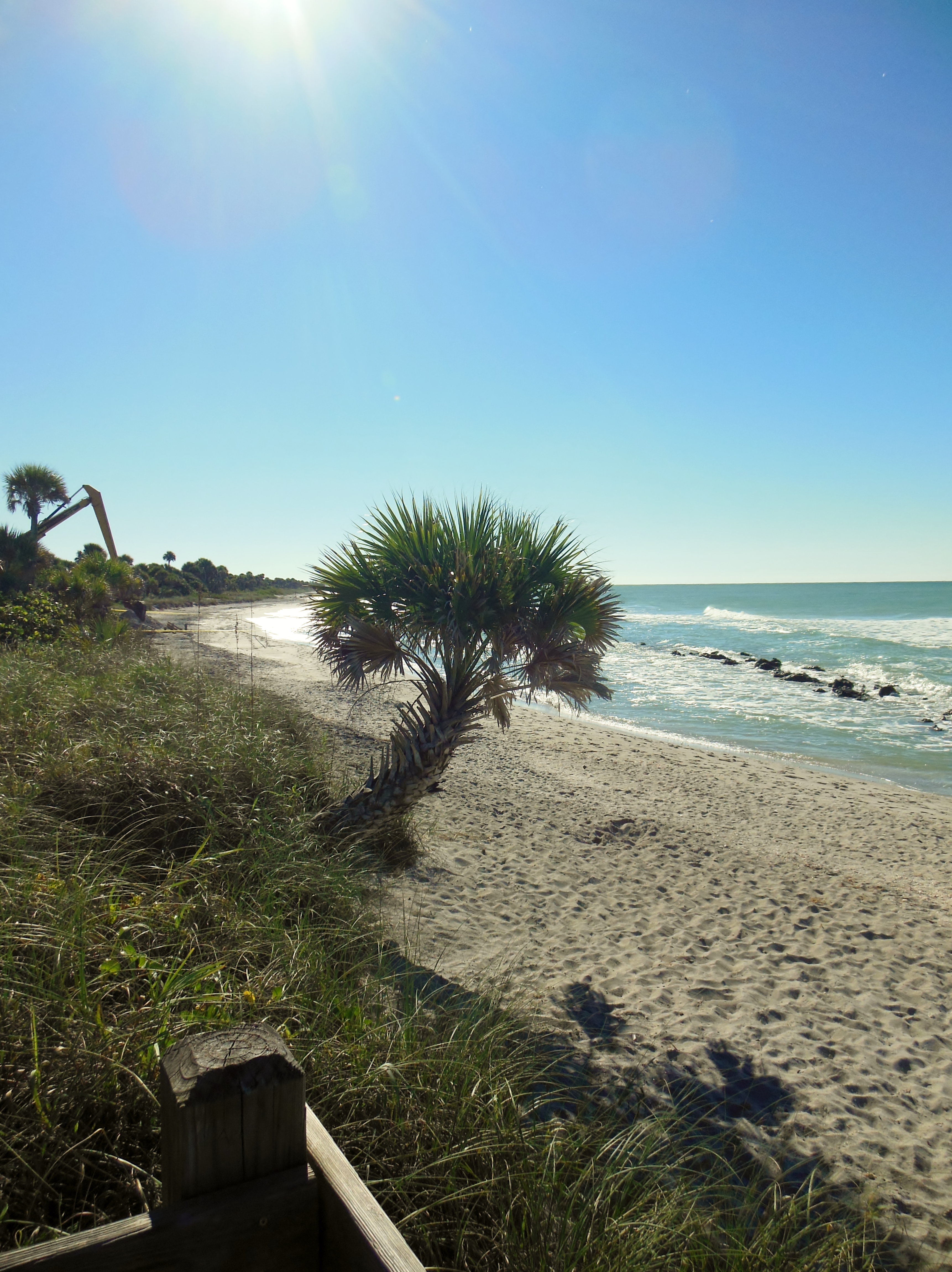
Today, however, is far to nice to head for a restaurant. I’m not so hungry yet and the wind is still on my back. I turn my trike down the north side of the trail and head for Caspersen Beach. This is one of the most enjoyable shelling beaches in the area and an excellent spot to find prehistoric sharks’ teeth! There are nature trails traveling through freshwater and saltwater marshes, mangrove areas, and tidal flats, and excellent opportunities for wildlife viewing. On warmer days this is a great spot to hop off the bike and take a cooling dip in the surf, but today is a bit to cool for my taste, although I do see several people swimming.
Follow the road past the beach to Harbor Drive South in Venice. Ride another mile or two past the Venice Municipal Airport and you come to one of the most famous restaurants in the area – Sharky’s on the Pier. Sharky’s sits smack dab on the Gulf in the Shark’s Tooth Capital of the World, it also boasts amazing sunsets, gorgeous views, and some darn good seafood! You will definitely be hearing more from us about Sharky’s before to long.
After lunch, take a quick cruise around the Maxine Bennett Park, directly next to the restaurant. Very pretty Gulf views, and nice little pond, and excellent people watching.
It’s been a busy ride so far today. We have now invested about 17 miles. There are a lot of choices from this point – Downtown Venice is available a few miles further on, and from here Casey Key is a not-to-distant ride. But the wind will be in my face on the way home, so for me today, I decide to turn around and head back home. All that other stuff will need to wait until another ride.